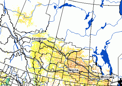
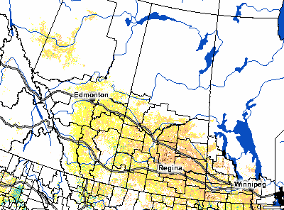
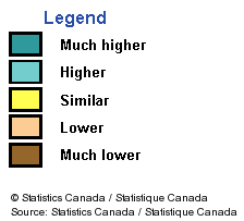
This map from StatsCan’s Crop Condition Assessment Program uses NDVI satellite imagery to show crop growth. This map compares growth to July 21 this year with the same period last year. Yellow indicates that growth is about the same as last year. Light brown is behind. As you can see, crop growth for most of the western Prairies is around the same pace as last year while most of the eastern Prairies is behind.